
Itinerary around Sant Ferran Castle
Routes
Time: 1h 25'
Distance: 4,7 km
Highest altitude: 105 m
Lowest altitude: 47 m
Accumulative slope ascent: 91 m
Accumulative slope descent: 91 m
Difficulty: Low
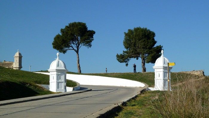
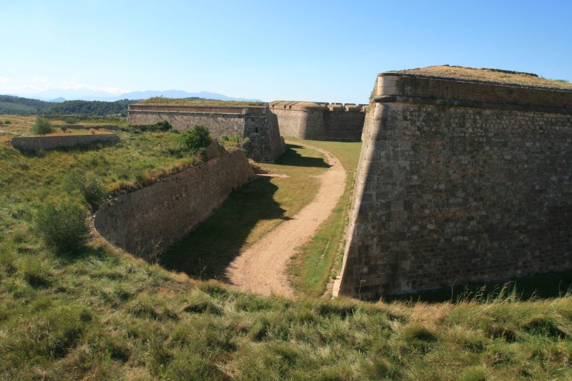
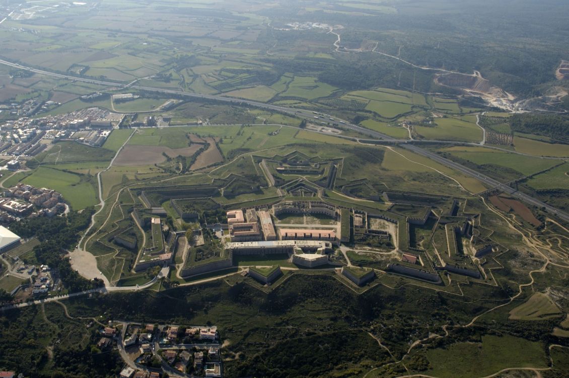
This is a short route in an area with great natural and historical character, in the middle of the town of Figueres, which takes you to Sant Ferran Castle, considered the greatest military fortress in Europe. The route starts at the Tourist Office in Figueres, located in the square Plaça de l'Escorxador nº2. Leaving the office, turn right in the direction to the square Plaça de la Palmera, Monturiol Street, Rambla and Lasauca Street until you reach the avinguda Salvador Dalí i Domènech, then for a few metres you will see the post AE245-Parc Bosc, which indicates that Sant Ferran Castle is a 15 minute walk away. Continue along the avenue until you reach the intersection with the street Pujada del Castell, which there, you will see a new flag, the F1, indicating that the walk around the castle takes approximately 45 minutes. You will also see an informative plaque about the prominent role of the fortress during the Spanish civil war which, among other facts, was the last meeting place of the Republican Courts on 1st February 1939.
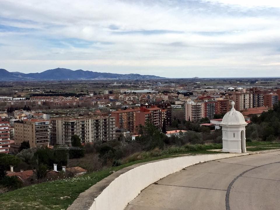
You start the walk around the castle by taking the path that runs just behind the poster, to the right of the castle. Along the route you can enjoy a splendid view ot the Empordà plain, the bay of Roses and the mountains of Cap de Creus, l'Albera and Les Salines in the region of Alt Empordà, and as you progress, you can take in the beautiful landscapes of the county of La Garrotxa, where on clear days, you can even see the Montseny massif. You should also look out for a herd of deer (Dama dama) that live within the castle perimeter.
The tour around the castle finishes at the starting point.